Greece Satellite Map with All Islands

Rent a Yacht Athens - Yacht Charters

   
Greece-S satellite view Greece-E satellite view Greece-N satellite view
Satellite view of Greece (cklic over)

Satellite Google Maps of Greece with Islands

Greece is located at the crossroads of Europe, Asia and Africa.

Greece is the birthplace of Democracy, Philosophy, Olympic Games, Mathematics, Astrology, Theater, etc.  From the 8th century BC, the Greeks were in the entire Mediterranean region and the Black Sea.  Alexander the Great spread Greek culture and sciences from Greece up to the 'Indus River' (India). Greece was annexed by Rome in the 2nd century AD.

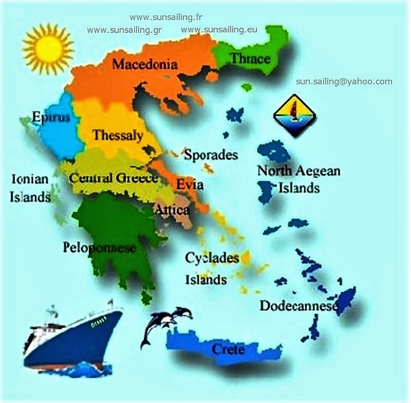
The main departments of Greek mainland:

Attica - Central Greece - Thessaly - Peloponnese - Epirus - Macedonia - Thrace.   Greece (Elláda or Hellás), is located in the southeastern of Europe. Total area ±131.950 km².  Population ±11.000.000.  Athens is the capital and largest city, followed by Thessaloniki.  Local time GMT +2 hours.

Some important places from Athens by bus, by ferry, or by car:

Cape Sounion-Poseidon temple (day-trip).  Delphi and Levadia town (day-trip).  The monasteries of Meteor (1-2days).  Epidaurus theater-Corinth canal (1 day).  Mycenae-Nafplio (1-2days).  From Piraeus port: Day cruise by ferry to the Saronic Islands (Aegina, Poros, Hydra).  Day sailing trips to Athens coasts, Aegina and Salamis islands. 

Discover the Greek Islands by a different way: Enjoy a sailing cruise from Athens, and visit in comfort 4-5 islands/week (overnights). 
How to charter - s/y Atlantis 43 - Cabin charter - Naturist cruise

Satellite maps of Greece - Island's name list:

The Greek archipelago includes: more than 3.000 islands and islets, only 227 are inhabited.  Coastline ±12,900 km of a national total of ±19,900 km.

This is  'Original Google map'.  select 'Satellite' or 'Map view'.  If you select 'view larger map ' you will leave our website.